 IranNatural attraction; Valley and river
Garmarud Valley
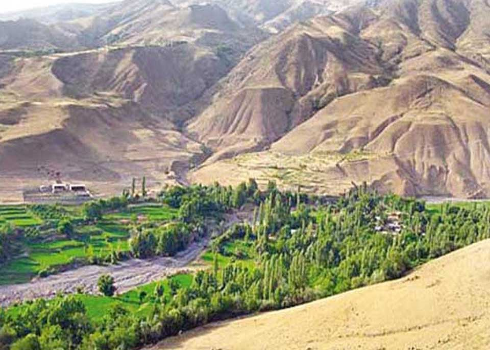
A green river valley of villages, orchards and mountain scenery in eastern Alamut.
Look first toward the floor of the valley, where the course of the water is the most evident feature. In some stretches the river moves quietly; elsewhere it narrows between rocks and steep slopes, making the structure of the land easier to read. Water has supported orchards, cultivated plots and nearby settlements. Local accounts identify smaller streams, including Khordrud and Zarsakrud. Khordrud passes between two hard-rock openings and forms what is known as Garmarud Waterfall before joining the main river. The waterfall belongs to the same natural system as the valley, its tributaries and the surrounding mountain gradients; it is not an unrelated feature placed beside them.
The orchards and agricultural parcels beside the water show how directly local life has depended on the river. In the more suitable pockets of land, fruit trees and cultivated fields appear against a background of bare rock and high slopes. The contrast between green vegetation, exposed soil and resistant stone gives Garmarud much of its visual character. The villages developed in a scattered way, following the terrain rather than imposing a regular plan upon it. At the foot of sharp rock faces, the older fabric of Garmarud village remains legible. From here, you can observe how homes, lanes and fields were arranged according to the slope and to access to water.
Garmarud belongs to the wider geography of Alamut, a mountain region set among the ranges of the central Alborz. The Alamut River rises on the western slope of Takht-e Soleyman and later joins the Taliqan River to form the Shahrud. These connections place Garmarud within a larger drainage system extending across the Alamut valleys. The region also has a strong historical identity, shaped by mountain settlements, fortified sites and difficult routes. Garmarud stands within that historical landscape, yet its meaning here is less about one fortress than about the continuing coexistence of village life and mountain nature.
As you examine the valley, notice the way light changes across the rock walls, the shifting width of the river channel, the distance between orchards and water, and the position of houses beneath the cliffs. These details express the history of the place without requiring a separate monument. Garmarud is not an empty scenic backdrop. It is a lived landscape in which water, land and people have remained interdependent across generations.