 IranHistoric attraction; Castle
Lambsar Castle
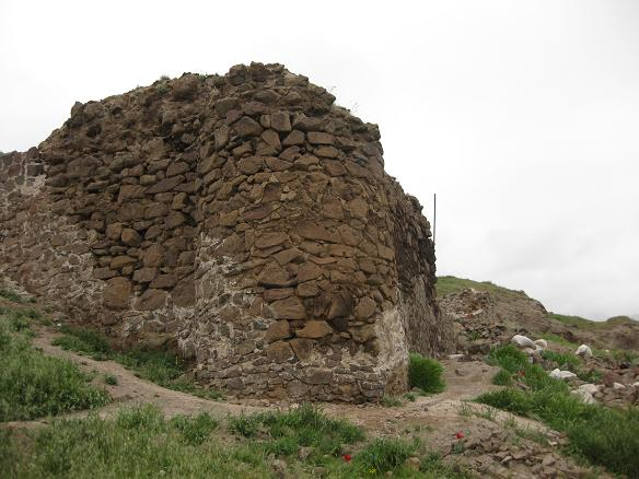
Lambsar Castle rises above a rocky platform near Razmian in western Alamut.
Lambsar was one of the largest and most strategically important Ismaili fortresses in Iran. Its history is closely associated with Kiya Buzurg-Ummid, a close associate and successor of Hasan Sabbah. Historical accounts place the capture of the fortress in 1102, although some traditions give 1096. Whatever the exact year, Lambsar had become a major military centre within the Ismaili system by the late eleventh or early twelfth century. Buzurg-Ummid is associated with its strengthening, and he is said to have held the fortress for roughly two decades before succeeding Hasan Sabbah. Lambsar was not simply a battlefield position. Large Ismaili castles could function as small towns, containing command spaces, living quarters, stores and administrative activity, while also serving as centres of learning and communication within the wider community.
Where the ground is firm, follow the trace of the outer walls. In some areas, the wall line still marks the edge of the rocky platform; elsewhere, fallen stones have merged with the natural outcrop. Observe the positions of the towers, the changes in elevation and the directions of view toward the valleys. An attacker would have had to climb exposed, difficult slopes, while the defenders occupied higher ground with restricted approaches and long sightlines. The distant scenery is therefore not merely a mountain panorama. It formed part of Lambsar’s system of observation and warning. Looking outward from the ruins helps explain why this site was valuable before any attempt is made to reconstruct the buildings that have disappeared.
Some of Lambsar’s most revealing features lie below eye level. Notice depressions, cut surfaces and openings associated with water storage or service areas. Archaeological and historical studies identify at least fifteen cisterns carved into the rock. A constructed channel, or qanat-like watercourse, also crossed the narrow neck of land between the fortress and the adjacent mountain mass. Rainwater collected during the wetter seasons could be stored for summer, autumn and periods of siege, while the nearby Nayinrud offered an additional source. Research estimates suggest that the combined system could supply approximately five hundred men and their horses and mules during the hot months. That figure is a historical assessment of capacity, not a modern facility that can be measured or used today.
In the southern and southeastern parts of the site, look for traces of stables, storage areas and other working spaces. Grain, water, fodder and repair work were as essential to endurance as walls and towers. Lambsar’s organization reveals a fortified settlement designed for prolonged occupation rather than a temporary refuge. A Seljuq siege in 1117 failed to capture the fortress, and another attack about a decade later also failed. After Alamut fell to Hülegü’s forces in 1256, Lambsar continued to resist for about a year before surrendering to the Mongol commander Dayer Buqa in 1257. The fortress was probably abandoned afterward. Its remaining walls and waterworks show that Lambsar’s strength came from a carefully balanced relationship between architecture and terrain: the stone structures did not merely sit on the mountain, but extended the mountain’s own defensive logic.
GPS
Address and location
Near Razmian, western Alamut, Qazvin County, Qazvin Province, Iran
↗ Directions in Google Maps